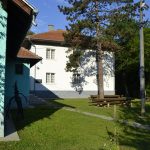
The Majdanpečka Domena Teaching Base
The “Crna reka” management unit is located in the northeastern part of Serbia, on the branches of the Homolje mountains and is a unique part of the former “University Domain”. It occupies an area between 44 ° 18 ‘and 44 ° 22’ north latitude and 19 ° 31 ‘and 19 ° 36’ longitude. This forest is located in the territory of the Municipality of Majdanpek and belongs entirely to the cadastral municipality of Debeli Lug. As a special-purpose forest, it is not part of the North Kučaj forest area.
Borders
In the northwest, this management unit borders the “Todorova reka” management unit. This border goes from the village of Debeli Lug to near the highest peak of the forest (Breza) and along the village ridge, which forms the watershed of the Black and Todor Rivers. On the southwest side – from the peak of Breza – the border passes by the private properties of the village of Laznica and coincides with the borders of the cadastral municipalities of Laznica and Debeli Lug. Thus, the border goes all the way to the three borders of the cadastral municipalities: Laznica, Jasikovo and Debeli Lug. On the eastern side, the forest border goes to the mentioned border, passing by the private estates of the villages of Jasikovo and Leskovo. That border also coincides with the borders of the cadastral municipalities of Jasikovo, Leskovo and Debeli Lug and descends over Jelenova Čuka along the ridge to the Veliki Pek. In the north, the border goes through the Veliki Pek, then past the village of Debeli Lug all the way to the beginning of the Village Ridge.
The outer border was stabilized by burying the boundary stones measuring 15 × 15 × 60 cm with a carved cross in the middle of the stone. The border with private properties was also been stabilized with prescribed stones. Coordinates are calculated for all these points.
In addition to the boundary stones, the outer boundary is marked visibly on the trees in red oil paint with three parallel horizontal lines at a height of about 1.50 m from the ground. The total length of the outer border is 27,800 m.
The total area of this management unit is 2,073.41 ha.
Private property enclaved in this management unit, covers 86.28 ha, and mostly consists of fields (58.81 ha), tree lines (7.61 ha), sports fields (6.67 ha), transmission lines (3.65 ha). ), streams (4.24 ha), roads (2.45 ha), cemetery (0.35 ha), meadows (0.29 ha), large game section (1.36 ha), pasture (0.18 ha), vineyards (0.37 ha), buildings and other objects with yards (0.30 ha).


